Read 4 blog comments on March 21st
…………………..
Sacramento Bee, Sunday March 27th, talks about hospitals neglecting potential flood problems.
......................................
 Walk UP the gangway to the Delta King? This shows how much the river is up. It is usually a long walk down.
………………………..
Sacramento Flood information Stages, with focus on Mercy hospital
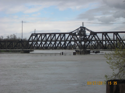
I St Bridge 31.0 Flood Elevation
I St Bridge Record High; 30.7
I St Bridge action Stage 25.5 (Last Week.)
Today at I St bridge 25.1
Mercy Front entrance area elevation about 26—27 (Google maps)
My driveway a few feet from the Mercy entrance.25.0
Truck Loading dock 17.0 (Google maps) This could be close to the elevation of the lower hospital floors.
Depending on where the levee breaks, Mercy General could have 4 feet coming in the main entrance and have all its lower levels filled.
My questions:
Is there a Mercy Hospital plan for dealing with a levee break from one of many rivers that surround Sacramento?
Is Mercy prepared to seal off all the entrances and protect lower elevations?
Were lessons learned about the hospital flooding at New Orleans being applied?
Why is the new building’s ground floor at a low elevation?

Just a thought. Should a flood occur the Delta King could sail right into town.
ReplyDeleteI read your blog everyday. Let's make East Sacramento residential friendly.